Appalachian Trail: Elm Street to Cape Moonshine Road
Appalachian Trail: Elm Street to Cape Moonshine Road
Pass Dartmouth College, hike over Smarts Mountain, and explore thick woodlands on this multi-day, 36-mile trip. Peakbaggers: Several side trails lead to nearby summits.
Heading out the door? Read this article on the new Outside+ app available now on iOS devices for members! Download the app.
Shelters: Velvet Rocks Shelter; sleeps 6. Moose Mountain Shelter; sleeps 8. Trapper John Shelter; sleeps 6. Hexacuba Shelter; sleeps 8.


Trail Facts
- Distance: 58.3
Waypoints
WPT001
Location: 43.7114983, -72.3239822
AT turns E onto Elm where you roadwalk 1mi. until Main St.; parking
WPT001
Location: 43.7025833, -72.2647476
Velvet Rocks Shelter
WPT002
Location: 43.9015503, -71.9846649
AT turns E along NH 25A .15mi before turning W; Gilmans Corner
WPT002
Location: 43.7006683, -72.2666702
Trail to Velvet Rocks Shelter
WPT002
Location: 43.7130547, -72.3083038
AT turns east (right) onto US 5. Optional: To reach the Norwich Public Library, turn left and follow the road for 0.2 mile.
WPT002
Location: 43.7023315, -72.2895355
AT follows S. Main St. Tip: Free slice of pizza for thru-hikers just a bit further down Main St. (see signs in shelters for the details).
WPT003
Location: 43.7836151, -72.1079178
Jeep trail
WPT003
Location: 43.7168121, -72.3086777
Norwich Public Library: This hiker-friendly library is a good place to check your e-mail.
WPT003
Location: 43.6978683, -72.2808838
COOP Groceries
WPT003
Location: 43.7042503, -72.2615814
Trail to shelter
WPT003
Location: 43.915699, -71.9647369
Cape Moonshine Road; parking
WPT004
Location: 43.6970482, -72.2805634
AT turns W following the edge of a field
WPT004
Location: 43.7925987, -72.1030807
AT crosses Lyme Dorchester rd; hike up the rd briefly before veering E back onto the trail
WPT004
Location: 43.7020836, -72.245697
Rock area
WPT005
Location: 43.7032013, -72.2422333
swamp
WPT005
Location: 43.7023163, -72.2647629
Velvet Rocks Shelter
WPT006
Location: 43.7028847, -72.2372513
Blue-blazed trail
WPT006
Location: 43.7968254, -72.0717392
Lyme-Dorchester Road; water source; Smarts Mountain Ranger TR
WPT007
Location: 43.7047997, -72.2299194
Trail
WPT007
Location: 43.8036995, -72.0672302
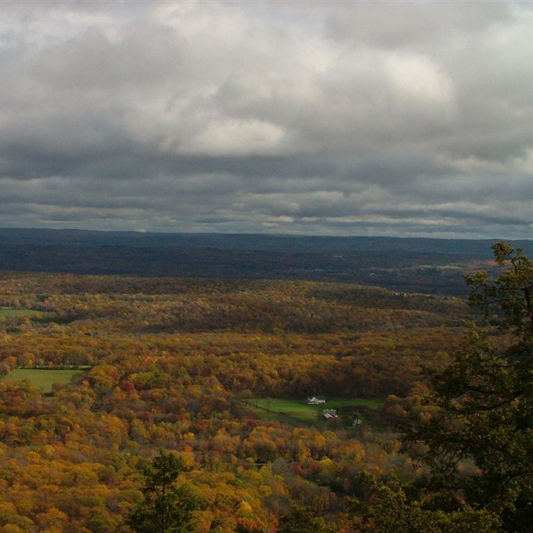
180-degree views
WPT008
Location: 43.8153648, -72.0611343
View to the ESE
WPT008
Location: 43.7052994, -72.229599
Trescott Rd; parking
WPT008
Location: 43.7034035, -72.2983551
AT continues straight. To take a dip in the Connecticut River, turn left and follow road.
WPT009
Location: 43.7035179, -72.2895584
Dartmouth Outing Club Office: This office maintains this section of the AT.
WPT009
Location: 43.7009392, -72.2894363
AT turns W (left) on Lebanon St.
WPT009
Location: 43.7068176, -72.2197342
Doubletrack
WPT009
Location: 43.8266335, -72.0446014
Smarts Mtn. Ranger Trail
WPT010
Location: 43.7827072, -72.1080475
Trail to shelter
WPT010
Location: 43.7066154, -72.2130203
Stream
WPT010
Location: 43.8256149, -72.0399475
Smarts Tent Site
WPT011
Location: 43.704216, -72.2121506
Etna-Hanover Center Rd
WPT011
Location: 43.8255157, -72.038063
Fire tower; great panoramic view
WPT012
Location: 43.8252983, -72.0375519
Firewarden’s Cabin
WPT012
Location: 43.7177505, -72.1762466
Three Mile Road
WPT013
Location: 43.7174149, -72.1685028
Harris Trail
WPT013
Location: 43.8648987, -72.0379639
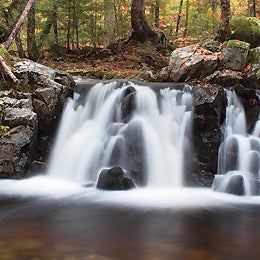
River; small waterfalls (south branch)
WPT014
Location: 43.7169151, -72.15802
AT crosses an unmarked trail
WPT014
Location: 43.8656158, -72.0371704
Gravel road
WPT015
Location: 43.7201004, -72.145401
Moose Mtn. South Peak (2,250 ft.); views to SSE
WPT015
Location: 43.8671684, -72.0327988
Eastman Ledges; view to the SW
WPT016
Location: 43.870285, -72.0286636
North Branch (Stream )
WPT017
Location: 43.7249184, -72.1501312
Orange-Black-Orange Blaze Trail
WPT017
Location: 43.8762169, -72.0268631
Hexacuba Shelter
WPT018
Location: 43.7266006, -72.1499023
Trail to Moose Mtn. Shelter
WPT018
Location: 43.8751335, -72.0282669
Trail to Hexacuba Shelter
WPT019
Location: 43.7281342, -72.1500168
2nd trail to Moose Mtn. Shelter
WPT019
Location: 43.8751831, -72.0283813
Stream
WPT020
Location: 43.7057495, -72.3059845
AT follows US 5 to Hanover, just across the Conn. River is Dartmouth
WPT021
Location: 43.7037849, -72.2999649
VT/NH state line. Look at the engraving on the Ledyard Bridge crossing the Connecticut River.
WPT021
Location: 43.877285, -72.03405
View to the S
WPT022
Location: 43.7048569, -72.2988052
Take a cool dip in the Connecticut River with Dartmouth students and rinse away the sweat and grime before heading into the town of Hanover.
WPT022
Location: 43.8857002, -72.0235825
Mt. Cube: The south summit has great 180-degree views
WPT023
Location: 43.7529182, -72.1247025
Goose Pond Road
WPT024
Location: 43.7750511, -72.1057816
View to the E (Holts Ledge)
WPT024
Location: 43.8864174, -72.0235138
Trail to N Peak Mt. Cube
WPT025
Location: 43.8856163, -72.0035172
Trail
WPT025
Location: 43.7766685, -72.1050797
Watch closely for where the white blazes turn W
WPT026
Location: 43.782917, -72.1112671
Trapper John Shelter
WPT026
Location: 43.8852158, -72.0018997
Brackett Brook
WPT028
Location: 43.8879509, -71.9978333
Stream
WPT029
Location: 43.8957825, -71.990036
Gravel Road
Views from North Peak
Location: 43.7443161, -72.134285
Views
Location: 43.8034382, -72.0661926
Views from Smarts Mountain
Location: 43.8251771, -72.0369244
Hexacuba Shelter
Location: 43.8763161, -72.026886