Appalachian Trail: Warwick Turnpike to NY 17A
Appalachian Trail: Warwick Turnpike to NY 17A
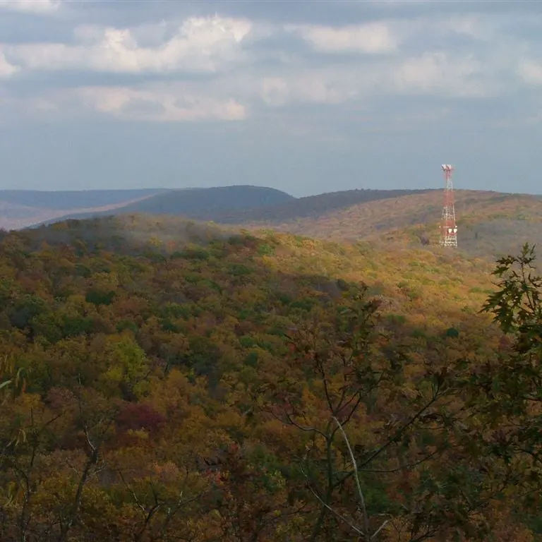
Connect New Jersey and New York on this rugged 8.6-mile route that traverses the glacier-cut spine of Bellvale Mountain.
Heading out the door? Read this article on the new Outside+ app available now on iOS devices for members! Download the app.
Shelters: None

Trail Facts
- Distance: 13.9
Waypoints
WPT027
Location: 41.20068359375, -74.3822326660156
Stream
WPT002
Location: 41.2057342529297, -74.321418762207
Rock outcrop
WPT011
Location: 41.1946830749512, -74.3392486572266
Prospect Rock: This rock outcrop offers view of Greenwood Lake
WPT016
Location: 41.1895179748535, -74.3478164672852
Ernest Walter Trail (yellow blaze)
WPT021
Location: 41.1959342956543, -74.3550338745117
Long House Stream
WPT017
Location: 41.1932678222656, -74.3508987426758
Small stream
WPT023
Location: 41.1955490112305, -74.3641204833984
Jeep road
WPT004
Location: 41.2022171020508, -74.324462890625
Rock outcrop
WPT001
Location: 41.2164001464844, -74.3144989013672
Stream
WPT025
Location: 41.1952667236328, -74.3716659545898
Long House Road (Brady Road); AT zigs E
WPT006
Location: 41.2011184692383, -74.3280029296875
Stream
WPT010
Location: 41.1956481933594, -74.3385162353516
Blue-blazed Zig Zag Trail to Cascade Lake Park
WPT020
Location: 41.1953506469727, -74.3540191650391
Gravel trail; AT zigs E
ZZZ029
Location: 41.2016983032227, -74.3910827636719
Warwick Turnpike
WPT015
Location: 41.188850402832, -74.3468704223633
Sharp turn W on AT
WPT051
Location: 41.2228012084961, -74.3086471557617
Views of Greenwood Lake
WPT049
Location: 41.2411346435547, -74.2890472412109
Telephone line
WPT013
Location: 41.1917152404785, -74.3439636230469
NY-NJ state line. Register; 50 ft. further is the State Line Trail marked by blue dot
WPT010
Location: 41.2442016601562, -74.286506652832
Turn R @ Continental Rd. toward NY 17A. Ice cream .1 mi. to the W; water available. Blue blazes lead 50 ft. N of 17A to hawkwatch and viewpoint
DSCF0432
Location: 41.2238006591797, -74.307731628418