Atlanta, GA: Coosa Backcountry Loop
Atlanta, GA: Coosa Backcountry Loop
On the edge of Chattahoochee National Forest, this 13.4-mile loop treks up several Blue Ridge peaks and meanders through north Georgia wildflowers and hardwood forest.
Heading out the door? Read this article on the new Outside+ app available now on iOS devices for members! Download the app.
Hiking west from the Vogel State Park Visitors Center, this 13.4-mile loop escapes deep into the Blue Ridge Mountains on a challenging loop on the Coosa Backcountry Trail. Rangers discourage dayhiking this route, but it is doable for fit hikers. Hiking through a mixed hardwood forest of oak, hickory, and white pine, the route crosses multiple forest creeks and (in season) samples a wide assortment of north Georgia wildflowers. Water sources are scattered throughout the loop (with the exception of the stretch from Slaughter Gap to Long Branch).
Hiked clockwise, the trail starts with a 3.5-mile, 1,700-foot climb up to Slaughter Mountain. From there, you’ll descend steeply to Wolf Pen Gap, before beginning another slog up Wildcat Knob and Coosa Bald. From there, the trail descends 2,100 feet over the next 3.6 miles before the final effort of the day, a gradual 700-foot climb around the contours of Frady Mountain and Sheriff Knob: not difficult in its own right, but tough on the legs after a long day of hiking. The final descent to the park is a welcome grade back to Vogel State Park.
-Mapped by Scott Sanders


Trail Facts
- Distance: 21.7
Waypoints
CBL001
Location: 34.7658958, -83.9241333
From the Visitors Center, walk southwest up the paved road towards the campground area.
CBL002
Location: 34.763855, -83.9264755
Turn right off the paved road up a set of stone stairs. At the top of the stairs, bear left onto a dirt path in front of a vending machine location. Though you’ll start seeing some green blazes here,the Coosa Backcountry Trail is primarily blazed with Yellow Rectangles. For the majority of this trip, you’ll be following yellow blazes, not green.
CBL003
Location: 34.7640724, -83.9283676
Bear left @ 3-way junction marked by a trail kiosk. Don’t take the Byron Reece trail (to the right).
CBL004
Location: 34.763504, -83.9303741
Cross a small wooden bridge, and immediately turn right at @ 3-way intersection, heading uphill. Here, the trail is marked by yellow and orange blazes.
CBL005
Location: 34.7631416, -83.932457
Go straight across an old dirt road bed at 4-way intersection onto a narrow dirt trail heading south uphill. Note: the loop of this route closes at this junction, and returns from here to the Visitors Center (after the loop).
CBL006
Location: 34.7555313, -83.9329529
Step over a small creek and turn right @ 3-way intersection. A picnic shelter is downhill to the left.
CBL007
Location: 34.7549362, -83.9334183
Turn right @ 3-way intersection, continuing to follow yellow/orange blazes.
CBL008
Location: 34.7546654, -83.9346542
The trail passes a small campsite next to a set of waterfalls. Ahead the trail climbs steeply up the north side of the drainage.
CBL009
Location: 34.7540779, -83.9362488
Cross the stream on a log bridge and then continue uphill (now following orange blazes). An old trail sign here might be confusing, but if in doubt, keep heading uphill. Immediately after this stream crossing the trail makes a switchback to the right between two huge boulders and starts a long series of switchbacks.
CBL010
Location: 34.7518806, -83.939743
Turn left @ 3-way intersection, following the wooden sign with a yellow arrow on it. Wolf Creek is on your right here. Ahead the trail continues to climb (passing a small campsite with no water) en route to Slaughter Gap.
CBL011
Location: 34.7471733, -83.9438095
Turn right @ 3-way intersection. The route to the left heads to Blood Mountain. Here, the Coosa Backcountry Trail shares a trail with Duncan Ridge Trail (and is marked by orange and blue blazes). A small campsite is 50 yards down the ridge from this intersection. Ahead, the trail will summit near the top of Slaughter Mountain and begin a long steep descent to Wolf Pen Gap.
CBL012
Location: 34.7639389, -83.9523773
Continue straight, crossing GA-180 at Wolf Pen Gap. Look for the yellow and blue blazes to the right of a gravel road (Duncan Ridge Road) that marks the trail’s return into the woods. From here, the trail climbs a steep stretch up Wildcat Knob.
CBL013
Location: 34.7719803, -83.9587173
Here, the trail descends from Wildcat Knob and merges with the gravel Duncan Ridge Road for about 50 yards. The return into the woods is marked by yellow and blue-blazed trail markers on the right.
CBL014
Location: 34.7774963, -83.9606476
Turn right @ 3-way intersection. To the left, the blue-blazed Duncan Ridge Trail continues another .25 mile or so to the Coosa Bald summit. Turning right to continue on the Coosa Backcountry Trail, you’ll head through a small campsite. From here on, the blazes are almost entirely yellow.
CBL015
Location: 34.7859306, -83.9537354
Continue straight across a gravel road. The trail immediately angles downhill and to the right after crossing the road. Ahead are a few campsites.
CBL016
Location: 34.788372, -83.9277267
Turn left @ 3-way and cross a small stream. There are several small campsites scattered throughout this area.
CBL017
Location: 34.786293, -83.9249496
Go straight across a gravel road into a gravel parking area with campsites, cross the wooden bridge, and turn left @ a 3-way junction. The Coosa Backcountry Trail is signed here. Ahead the trail climbs about 700 feet, following contour lines west around Frady Mountain and Sheriff Knob.
CBL018
Location: 34.7680664, -83.9395752
Continue straight across GA-180. On the other side of the road, the trail heads back into the woods and is marked by a yellow blaze.
CBL019
Location: 34.763195, -83.9330521
Cross a wooden bridge and then turn left @ 3-way intersection. Proceed to waypoint 5 and backtrack to the Visitors Center.
Blood Mountain View
Location: 34.7493704, -83.9491081
From Slaughter Mountain, a view of Blood Mountain (large on right) and Yonah Mountain (small half dome on left in the distance).
Visitors Center
Location: 34.7658711, -83.9240026
The Visitors Center at Vogel State Park
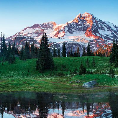
Vogel State Park
Location: 34.7662589, -83.9237452
A lake view from the Vogel State Park Visitors Center
Metal Blazes
Location: 34.7585731, -83.9304399
Most Coosa blazes are paint, but occasionally you’ll see metal ones.
Blood Mountain Wilderness Area
Location: 34.7548005, -83.9337444
Just Below Slaughter Gap
Location: 34.7491236, -83.9421129
Wildcat Knob View
Location: 34.7562814, -83.9487648
A view of Wildcat Knob across GA-180
Wolf Pen Gap View
Location: 34.7621341, -83.9510822
Warning Sign
Location: 34.7636501, -83.9523268
Vogel State park is 3 miles down GA-180 to the east if you need to re-route and cut the trip short. Otherwise, it’s almost 9 miles back to the Visitors Center if you continue on the Coosa Backcountry Trail.
Wildcat Gap
Location: 34.7720757, -83.958807
Wildcat Gap next to Duncan Ridge Road
Chattahoochee Views
Location: 34.7809939, -83.9573908
Long Branch Creek Campsite Area
Location: 34.7827211, -83.9580345
The Long Branch Creek camping area is set along an old logging road.
Trailside Rock Formation
Location: 34.788008, -83.9265347
Wolf Creek
Location: 34.786422, -83.9254189
Trail Waterfall
Location: 34.7786323, -83.9331007
Trailside Creek
Location: 34.763227, -83.9302683