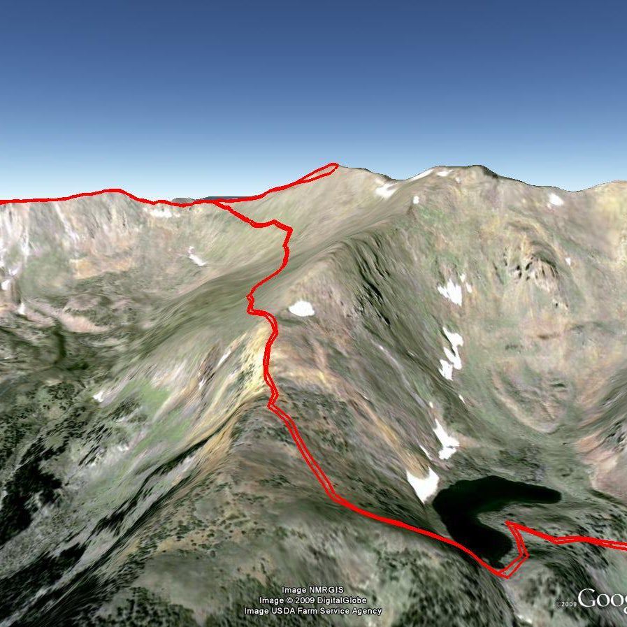
Boise, ID: Reynolds Creek Loop
Boise, ID: Reynolds Creek Loop
Less than an hour from Boise, this 7.4-miler in the Owyhee foothills weaves through rock formations, traces Reynolds Creek, and tracks through a towering red rock canyon.
Heading out the door? Read this article on the new Outside+ app available now on iOS devices for members! Download the app.
To begin, pick up Trail #300 on the west side of the parking lot. Ignore trails branching off to the left in the first mile. At mile .9, you’ll cross a road and continue on the singletrack. The trail climbs one last hill and then widens into a two-track and descends to a T-junction at a dirt road (mile 1.8). Go right and then left on Trail #410, a sandy wash going downhill towards Reynolds Creek.
At mile 2.3, go right on Trail #310 and proceed for a half mile to a junction with Trail #600, the China Ditch trail. Go right and walk upstream along Reynolds Creek for a long mile. At a junction with Trails #510, #601 and #610, go right on #510 and climb out of the canyon.
At mile 4, bear right at a Y junction and stay on #510 to BLM dirt road #37154. Go right and follow the road to the junction with Trail #400. Go left on #400 at mile 5.28 and head back to the trailhead. At the top of the first hill, you can either stay on Trail #400 or branch off on #300 to the right. Both ways return to the start.
-Text by Steve Steubner
TO TRAILHEAD: Take I-84 W to the Franklin Rd. exit (City Center) in Nampa, and turn left. Follow Franklin to the junction with 11th St. Turn right and take 11th into downtown. Follow signs for ID 45 S and take it to Walters Ferry. Turn right on ID 78, heading for Marsing. In a couple miles, turn left on Wilson Creek Rd. Proceed up the paved road until it turns to dirt and pull into a dirt parking area on the left.
Waypoints
REY001
Location: 43.350008, -116.709512
Trailhead on Wilson Creek Road
REY002
Location: 43.326153, -116.700414
Turn left at Y-junction on Trail #410 to begin a clockwise loop.
REY003
Location: 43.325385, -116.685238
Turn right onto Trail #600.
REY004
Location: 43.313243, -116.698236
Turn right onto Trail #510.
REY005
Location: 43.318309, -116.707098
Turn right at T-junction.
REY006
Location: 43.325982, -116.700565
Bear left at Y-junction on Trail #400.