Canyonlands National Park Is a Sculpted Stone Wonderland. Here Are the Best Hikes to Explore It.
Canyonlands National Park Is a Sculpted Stone Wonderland. Here Are the Best Hikes to Explore It.
From half-mile jaunts to long backcountry routes, these hikes are a quick way to get to know Utah’s largest national park.

Heading out the door? Read this article on the new Outside+ app available now on iOS devices for members! Download the app.
Canyonlands National Park is home to some of the best hikes Utah has to offer. The park is a vast, rugged expanse of high desert in the state’s southeastern corner just outside Moab, where water has sculpted 527 square miles of canyons, mesas, arches, and spires. Divided by the Green and Colorado Rivers into three distinct districts—Island in the Sky, The Needles, and The Maze—Canyonlands offers a variety of hiking experiences, from family-friendly trails with sweeping views to remote, challenging routes for seasoned backcountry explorers. Isolated from one another, the areas each offer unique terrain and adventures.
Here is a breakdown of the best hikes in each district of Canyonlands National Park.
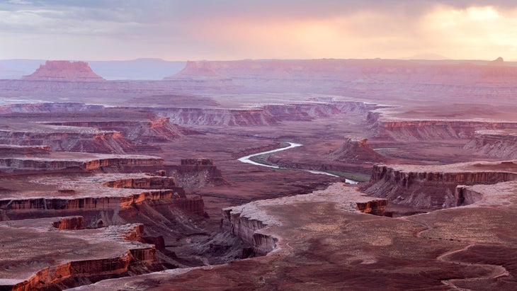
Island in the Sky
Island in the Sky is a large, flat-topped mesa easily accessible from Moab that offers spectacular views. It’s also the most popular area of Canyonlands.
Mesa Arch Trail
Trail Facts
- Distance: .7 miles round trip
- Elevation Gain: 56 feet
- Difficulty: Easy
- Trailhead: Mesa Arch Parking Area
What Makes It Great
Easily accessible cliffside arch with iconic views of the La Sal Mountains, especially at sunrise.
What to Expect
At just over a half-mile, the Mesa Arch Trail is an easy way to experience one of the most photographed arches in Utah. The 27-foot-long Mesa Arch sits on the edge of a 500-foot cliff above Buck Canyon and frames spectacular views of the canyon below, the La Sal Mountains, Washer Woman Arch, Monster Tower, and Airport Tower. A mix of uneven, rocky terrain and slickrock, this short, lollipop loop is great for families. Exercise caution near the arch’s edge, especially if you have kids, as the drop-off on the other side is not blocked by anything.
Upheaval Dome Overlooks Trail
Trail Facts
- Distance: .6-1.2 miles
- Elevation Gain: 115 feet
- Difficulty: Moderate
- Trailhead: Upheaval Dome Parking Area
What Makes It Great
A quick hike to great views of one of Utah’s most mysterious geological features.
What to Expect
This moderate 1.2-miler offers two overlooks with clear views of Upheaval Dome, a 3-mile-wide crater-like feature possibly created by meteorite impact or salt dome formation. The first overlook is .3 miles up the trail and has views of the Dome’s center. The second overlook is higher along the trail at .6 miles and is more secluded. It provides additional perspectives of the Dome and sweeping views into the broader Upheaval Canyon.
Syncline Loop
Trail Facts
- Distance: 8 miles
- Elevation Gain: 1,500 feet
- Difficulty: Challenging
- Trailhead: Upheaval Dome Parking Area
What Makes It Great: It’s the most challenging trail in Island in the Sky, and one of the most scenic.
What to Expect
The Syncline Loop Trail is a popular backcountry loop known for its steep switchbacks, boulder scrambles, and significant elevation change. It circles the Upheaval Dome but doesn’t provide views of the curious feature unless you hike the spur trail to the Upheaval overlooks. Best tackled clockwise, the route offers solitude, dramatic canyon views, and a taste of Utah’s wild desert landscapes. The trail is difficult and recommended for experienced hikers only.
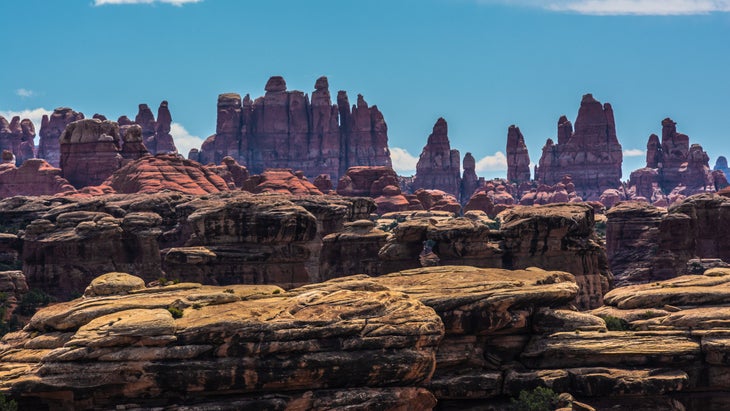
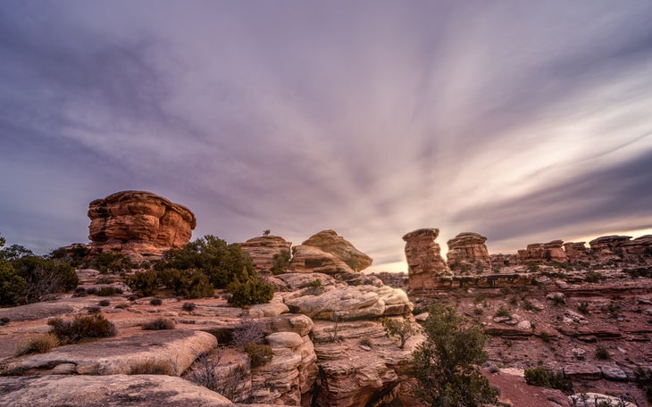
The Needles
The Needles is known for its colorful sandstone spires and remote beauty. Its challenging 60-plus miles of trails are ideal for long day hikes and multi-day trips.
Slickrock Foot Trail
Trail Facts
- Distance: 2.6 miles
- Elevation Gain: 73 feet
- Difficulty: Easy
- Trailhead: Slickrock Foot Trail Parking Area
What Makes It Great
Beginner hikers rejoice! The trail provides panoramic vistas at multiple viewing points and an accessible, overall introduction to the park.
What to Expect
The 2.4-mile Slickrock Foot Trail loop traverses a sandstone mesa and offers expansive views of Big and Little Spring Canyons, the Needles formations, and distant mountain ranges. Marked by cairns, the trail includes multiple scenic overlooks over the southeastern corner of Canyonlands National Park. The trail is slickrock, but with very little elevation gain, which gives you a chance to get used to hiking on this unique terrain.
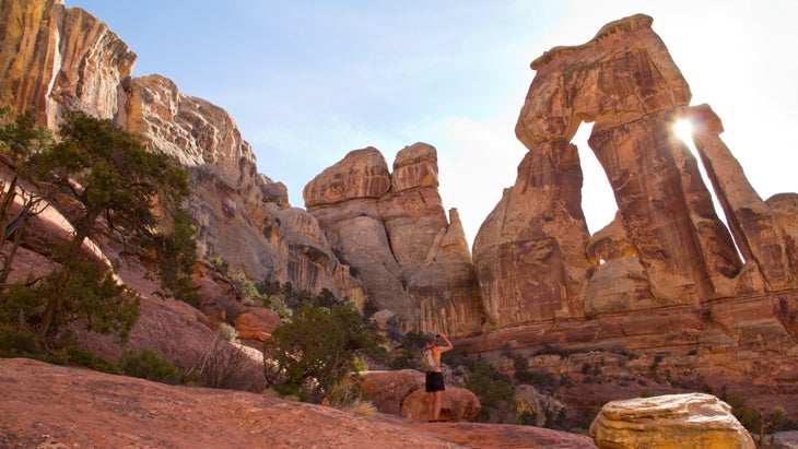
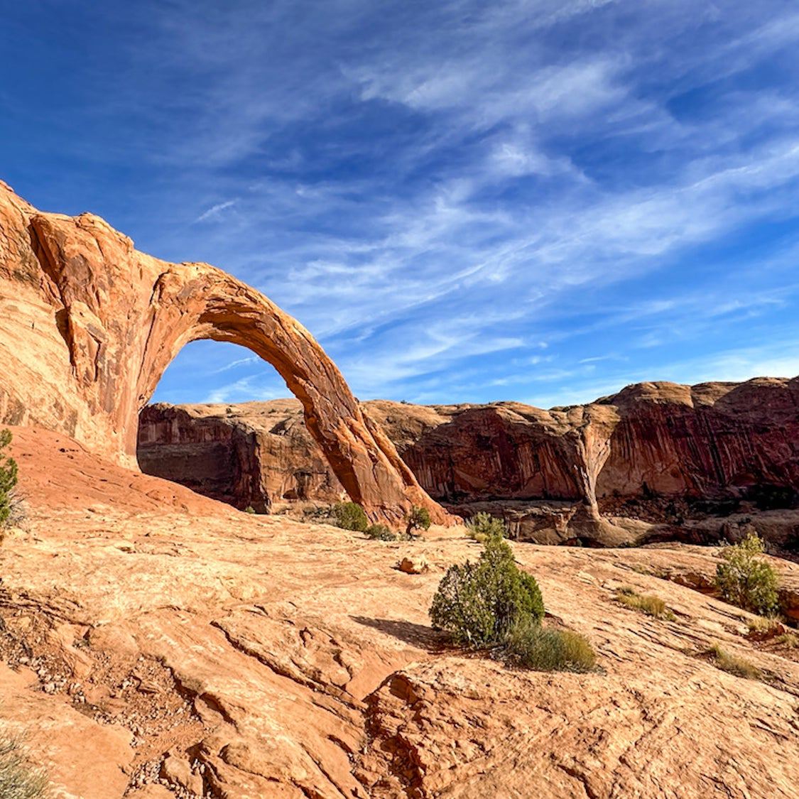
Druid Arch Trail
Trail Facts
- Distance: 10.8 miles
- Elevation Gain: 503 feet
- Difficulty: Challenging
- Trailhead: Elephant Hill Trailhead
What Makes It Great
Stunning scenery throughout the entire hike: The Needles, colorful rock formations, and Druid Arch.
What to Expect
The Druid Arch Trail leads to one of Canyonlands’ most iconic landmarks: the 150-foot-tall Druid Arch, a dramatic formation of Cedar Mesa Sandstone. The route winds through Elephant Canyon, offering striking views of the Needles, colorful rock formations, and the rugged desert terrain that defines the Needles district. The final approach requires a steep climb, including a ladder and rock scrambling, before arriving at the base of the towering arch. Return the way you came.
The Maze
What Makes It Great
Utter solitude, stunning red rock scenery, ancient rock art like the Harvest Scene, and the challenge of backpacking in one of the country’s most remote areas.
What to Expect
Because of the remoteness of the Maze District, access typically involves long, technical four-wheel drives, and most hikes are multi-day backpacking routes into deep canyons and isolated basins. The area is a true wilderness that demands preparation and navigation skills.
Part of the fun of The Maze is exploring it for yourself. This landscape features a labyrinth of sandstone canyons, cliffs, and expansive slickrock. The trails here are minimally marked and often require overland route-finding using a map and compass, not GPS, as signals aren’t reliable. Careful planning for water sources is also imperative. There are many trails once you are deep in the Maze that you may want to check out during your backpacking adventure, including the Maze Overlook, Chocolate Drops, and Harvest Scene via Pete’s Mesa.
Permits & Logistics
Permits
You do not need permits to day hike in Canyonlands National Park. You will need a permit if you plan to camp overnight. Reservations for camping are recommended.
Best Time to Go
Spring or fall is the best time to visit the park. The temps are moderate during these seasons, making it more comfortable to explore than the summer’s 100-plus-degree heat and the freezing temps in winter.
From 2025