Shenandoah National Park: Overall Run
Shenandoah National Park: Overall Run
Follow this cascading stream to scenic Shenandoah vistas along this 12.1-mile loop.
Heading out the door? Read this article on the new Outside+ app available now on iOS devices for members! Download the app.
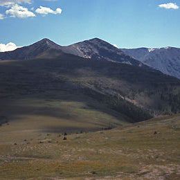
This 12.1-mile loop descends along rushing Overall Run, which forms the highest waterfall in Shenandoah National Park. From the Appalachian Trail off Skyline Drive (mile 21), trace the Blue Ridge south for half a mile to the Tuscarora—Overall Run Trail. In 2 miles, stay straight on the Overall Run Trail. You’ll reach the 29-foot upper falls a mile later as the trail emerges onto rocky outcrops for sweeping views of the valley and the 93-foot lower falls. In another 3 miles, take a sharp left onto the Beecher-Overall connecting trail. Rock-hop the run; on the other side, hike a mile to the Beecher Ridge Trail. For camping, look for level areas in the valley near the creek before looping back up the mountain. Free permits are available at entrance stations. –Hike provided by Russ Manning, author of 75 Hikes in Virginia’s Shenandoah National Park (The Mountaineers Books).
Waypoints
Parking Lot on Skyline Drive (mile 21.1)
Location: 38.7614479, -78.2817383