Wheeler Peak Wilderness, NM: Wheeler Peak Loop
Wheeler Peak Wilderness, NM: Wheeler Peak Loop
Connect alpine lakes and tag three summits on this wildflower- and wildlife-packed loop.
Heading out the door? Read this article on the new Outside+ app available now on iOS devices for members! Download the app.
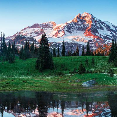
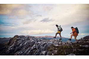
Singleminded highpointers flock to 13,161-foot Wheeler Peak (New Mexico’s highest) via two short trails from Taos Ski Valley, west of the peak. Let them. Climb from the east on this three-day, 19.1-mile loop and get the same bragging rights—plus a chance to summit two more 13,000-foot peaks.
From the East Fork trailhead, dive into the woods and track along the East Fork of the Red River. Keep right at the junction with the Sawmill Park Trail at mile .9, continuing the mellow ascent as the flame-colored Sangre de Cristo Range peeks above the trees.
In 3.2 miles you’ll reach the first big vista–a perch overlooking the East Fork valley 1,000 feet below.Enter the Wheeler Peak Wilderness just beyond and cruise .5 mile through conifer forest to a junction for the spur trail to Horseshoe Lake. Go left and head .5 mile to a treeline campsite with peak views.
Rise by seven to beat Wheeler’s frequent summer lightning storms. With a summit pack, hike .3 mile to Horseshoe Lake, a curved pool sitting directly under the high point. Then ascend 1.3 miles to the 12,900-foot saddle between Wheeler and Simpson Peaks. Go right to bag Wheeler and savor views of glassy tarns radiating below your feet.
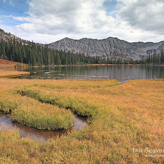
Now bag two more peaks before lunch: Return to the saddle and head .2 mile southeast to 12,976-foot Simpson, then continue another half-mile to 13,113-foot Old Mike Peak. Backtrack to Horseshoe Lake, retrieve your gear, and hike less than a mile on the Lost Lake Trail to reach your next campsite, on Lost’s north shore.
On day three, traverse talus slopes before descending through evergreens to reach the Middle Fork trailhead; roadwalk 2.6 miles east on Forest Roads 487 and 58A to your car.
Gear Up: Get batteries and fuel at Climates: 307 E. Main St., Red River, NM; (575) 754-1756
Contact: (575) 758-6200
-Mapped by Elisabeth Kwak-Hefferan


Trail Facts
- Distance: 30.9
Waypoints
WPL001
Location: 36.6062282, -105.3841297
Start hiking south from the East Fork trailhead.
WPL002
Location: 36.599047, -105.3824809
Cross rushing Sawmill Creek on a small bridge.
WPL003
Location: 36.5937526, -105.3828374
Keep right at the junction with the Sawmill Park Trail.
WPL004
Location: 36.5729702, -105.3818329
At mile 2.4, cross a small brook.
WPL005
Location: 36.5711732, -105.3818172
Cross the East Fork of the Red River via bridge.
WPL006
Location: 36.567598, -105.3863955
Cross a creek once again over a rickety two-log bridge.
WPL007
Location: 36.564644, -105.3926129
Pass a peaceful meadow to the right.
WPL008
Location: 36.565518, -105.3924557
Gaze up to the left at this steep scree field (and hazardous avalanche chute in the winter).
WPL009
Location: 36.5677926, -105.3926
Enjoy your first big vista here. This clifftop perch offers a peek at the East Fork valley below.
WPL010
Location: 36.56719, -105.3939688
Enter the Wheeler Peak Wilderness here.
WPL011
Location: 36.5698479, -105.3999539
Junction with the Horseshoe Lake spur trail. Turn left and begin climbing to reach the lake.
WPL012
Location: 36.5688135, -105.4029003
Splash across a small waterfall.
WPL013
Location: 36.5673567, -105.405364
Pitch a tent in this secluded, sheltered spot (camping is prohibited within 300 feet of the lake).
WPL014
Location: 36.564832, -105.4051769
Horseshoe Lake: Spend some time with dark, furry marmots on its U-shaped shoreline.
WPL015
Location: 36.5522547, -105.4165622
Here, you’ll gain the saddle between Wheeler and Simpson peaks. Turn left to summit Wheeler Peak, New Mexico’s high point first.
WPL016
Location: 36.5568386, -105.4168824
Wheeler Peak (13,161 feet). Retrace your steps to the saddle and continue south to Simpson Peak.
WPL017
Location: 36.5490405, -105.4143377
Stand atop 12,976-foot Simpson Peak, then continue southeast to Old Mike (yes that’s a peak name, not a person).
WPL018
Location: 36.5453713, -105.4064972
Take in the last mountaintop views of the day on 13,113-foot Old Mike Peak. From here, return to Horseshoe Lake, then the trail junction and turn left to Lost Lake.
WPL019
Location: 36.5785579, -105.4040766
Camp on the north side of Lost Lake for the best sites.
WPL020
Location: 36.6111597, -105.4127017
Turn right onto Forest Road 487.
WPL021
Location: 36.6213722, -105.3945043
Turn right onto Forest Road 58A and continue back to your car.
3D: Horseshoe Lake to Wheeler Peak
Location: 36.5637031, -105.403862
East Fork Red River
Location: 36.5912162, -105.3820181
Creek Crossing
Location: 36.571217, -105.3817177
Trail Views
Location: 36.5665755, -105.3924465