Explore Narnia or Walk With a Saint on These 5 Northern Ireland Treks
Explore Narnia or Walk With a Saint on These 5 Northern Ireland Treks
Hike alongside basalt cliffs, through lush meadows, and between tiny towns in this lesser-traveled region of Ireland.

Heading out the door? Read this article on the new Outside+ app available now on iOS devices for members! Download the app.
On Northern Ireland’s best trails, a hike isn’t just a hike. Pick the right path, and you could find yourself walking in the footsteps of giants, traveling the scenery that inspired Narnia, or following in the footsteps of a real-life saint. From the soaring basalt cliffs and castles of the Causeway Coast Way to the whimsical forests in Rostrevor, hikers can have their pick of routes that most tourists visiting the Emerald Isle never touch. (Looking to cap your adventures with a whiskey toast? You can do that here, too.) Opt for an adventure on these underrated hikes, ranging from 3 to 279 miles.
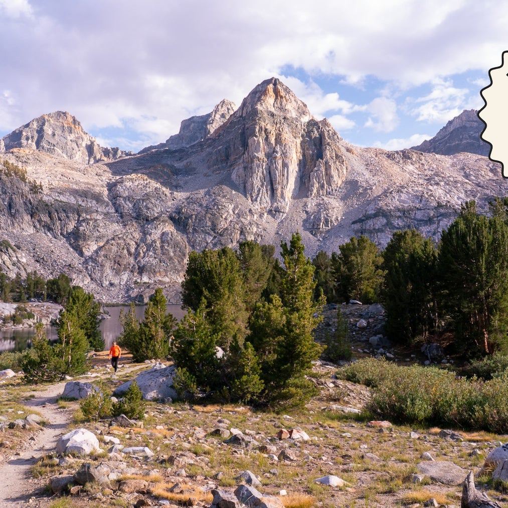
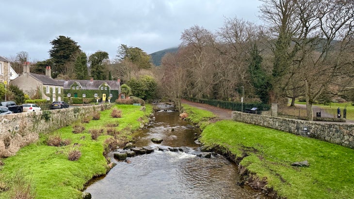
Rostrevor Forest Circular
Location: Rostrevor, County Down
Trail Type: Loop
Mileage: 7.5 miles
The 7.5-mile Rostrevor Forest Circular is straight out of a storybook. We aren’t kidding: You can hike the very forest that inspired C.S. Lewis’s mythical storytelling in The Chronicles of Narnia, just one and a half hours north of Dublin in County Down. The fairy-tale lands of the Rostrevor Forest will ignite your imagination as you stroll through grassy glens strewn with mossy boulders, duck into dark woods packed with Douglas fir and Sitka spruce, and soak in views from the peaks of Slievemeen and Slievemartin of the Mourne Mountains and the glimmering glacial fjord of Carlingford Lough. If you bring kids along, you’ll also want to explore the 0.5-mile storybook-inspired “Narnia Trail” loop in nearby Kilbroney Forest Park. Need more? Don’t miss out on a post-hike whiskey tasting at Ireland’s smallest distillery—Killowen Distillery—in the neighboring town of Killowen.
Causeway Coast Way
Location: Ballycastle, County Antrim to Portstewart, County Londonderry
Trail Type: Point-to-Point
Mileage: 32 miles
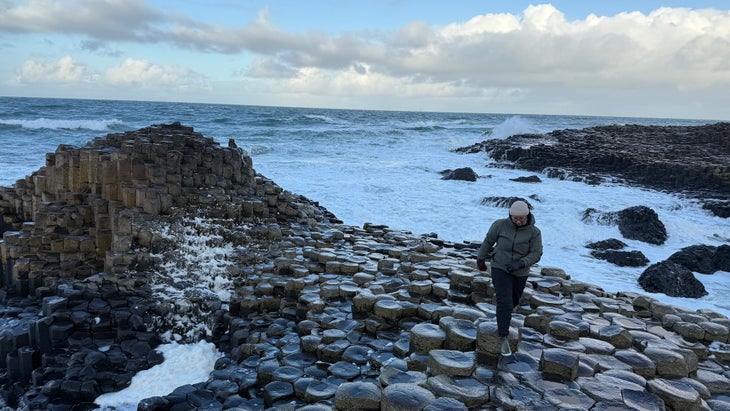
Dreaming of hiking Ireland’s famously rugged coastline? Look no further than the Causeway Coast Way. The approachable two- to three-day coastal walk links the popular tourist towns of Ballycastle and Portstewart, so no need to pack a tent. Hikers will pass through some of Northern Ireland’s most-visited stops—like the Giant’s Causeway, Carrick-a-Rede Rope Bridge, and Dunluce Castle—on the 32-mile route.
By far, the most well-known geological marvel along the journey is the Giant’s Causeway, where tens of thousands of interlocking basalt columns formed by ancient volcanic activity over 60 million years ago engulf the shoreline. The landscape transforms into a natural playground where hikers can ascend the columns like a staircase, hop over foamy tidal pools from one hexagonal spire to the next, and take a seat to watch the waves crash on the coast. Before or after your time on the trail, make the Bushmills Inn your basecamp so you can swing by the historic Bushmills Distillery for authentic Irish whiskey sampling and tour the infamous ruins of the 13th-century Dunluce Castle.
Saint Patrick’s Way
Location: Armagh, County Armagh to Downpatrick, County Down
Trail Type: Point-to-Point
Mileage: 82 miles
Walk in the footsteps of Saint Patrick—Ireland’s patron saint—along the Saint Patrick’s Way. Known as “Tochar Phádraig” in Gaelic, it’s one of the oldest-surviving pilgrimages in the Republic of Ireland. The theological route dates back 1,500 years and stretches from the ancient city of Armagh to the famed town of Downpatrick, the final resting place of the trail’s namesake.
You’ll hop between B&Bs along the route, which connects eight prominent towns: Armagh, Scarva, Newry, Rostrevor, Hilltown, Newcastle, Dundrum, and Downpatrick. Along the way, you’ll will take in the dramatic backdrop of the Mourne Mountains’ granite peaks that pop against the chalk grasslands of South Down, which burst with bluebells, primrose, and wild garlic and thyme in the spring. Wayfarers can keep track of their progress by collecting hand-pressed stamps at 10 designated posts, which feature interpretive history and facts at each waypoint. Pick up a free Pilgrim’s Passport at the Armagh Visitor Information Center near the trailhead.
International Appalachian Trail Ulster-Ireland Segment
Location: Donegal, County Donegal to Larne, County Antrim
Trail Type: Point-to-Point
Mileage: 279 miles
There’s good reason The Ulster Way stands as Northern Ireland’s most notable long-distance trek. In total, the 636-mile loop trail spans all six Northern Irish counties, giving hikers a glimpse of Northern Ireland’s remarkable and varied terrain. But if you can’t commit to the full thru-hike, opt instead for the International Appalachian Trail (IAT) Ulster-Ireland, a geological narrative 400 million years in the making.
Starting in west Donegal, the journey takes hikers through the Sperrins Mountains, the Causeway Coast, and the Glens of Antrim before ending in the coastal town of Larne. The cross-border journey traverses the region’s most magnificent landscapes—from the sea cliffs of Donegal to the otherworldly geology of the Causeway Coast and across mountain passes that once stood alongside peaks in North America.
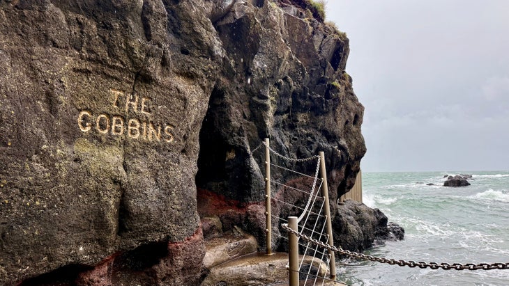
Gobbins Cliff Path
Location: Islandmagee, County Antrim
Trail Type: Out-and-Back
Mileage: 3 miles
Take cliff walking to the next level on this short yet intrepid trek. The Gobbins Cliff Path is a 3-mile out-and-back hike that follows a narrow walkway carved into sheer basalt cliffs. You’ll walk along storm-lashed basalt walls that plummet into the ocean, while heavy-duty, chain-linked rope and thick metal railings protect you from being dragged out to sea.
The builders of the original Gobbins pathway forged it in 1902 with pickaxes and sheer strength. The modern trail features modern updates like stainless steel girder bridges and high-tension cables, allowing trail-goers to travel over gaping chasms that churn with waves below. Visitors must book a guide and wear a helmet to hike the trail. Note: As of April 2025, the Gobbins Cliff Path is closed due to a large rockfall. Crews are working to restore and reopen the trail ASAP. Watch for updates on the website.
When to Visit Northern Ireland
Northern Ireland’s moderate maritime climate makes its landscapes accessible most of the year. Avoid January and February if you want to skip hiking in the snow, which is infrequent but a possibility/
Peak tourist season runs from April to October, with the heaviest foot traffic in July and August—especially at popular spots like the Giant’s Causeway and the Mourne Mountains. Temperatures tend to range from the low 40s to the high 50s Fahrenheit in the spring, mid-50s to 60s in summer, and 40 to 50 degrees in fall.
Rain is common year-round, so pack waterproof gear, such as Gore-Tex hiking boots, heavy-duty rain jackets, and rain pants. You’ll also want to watch weather reports closely, particularly when hiking exposed coastal paths or more challenging terrain in the Mourne Mountains.
Permits
Tickets are required for entry into the Giant’s Causeway and the Gobbins Cliff Path hikes. A guide is required to hike the Gobbins Cliff Path, and tour spots are available on a first-come, first-served basis. Advanced reservations are available for both destinations. The remaining hikes on this list don’t require permits.
From 2025