I’ve Hiked New Zealand’s Te Araroa Trail. Here’s How You Can Do It Too.
I’ve Hiked New Zealand’s Te Araroa Trail. Here’s How You Can Do It Too.
Cross the whole length of New Zealand's two main islands on this 1,900-mile thru-hike.
Heading out the door? Read this article on the new Outside+ app available now on iOS devices for members! Download the app.
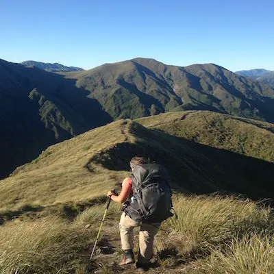
New Zealand’s Te Araroa Trail (TA)—”the long pathway” in Māori, the language of the indigenous Polynesian people in New Zealand—is not your typical thru-hike. It’s a pathway featuring everything from coastal beach walks to lush farmland, from thriving urban cities to suburban neighborhoods, and from dense forest to high alpine.
While the TA comprises 160 tracks of varied distances, such as the iconic 20-mile Tongariro Crossing or the 45-mile Queen Charlotte Track, around 15 percent of the trail consists of road walking that connects the different sections. There’s also more to the TA than just walking; there’s cycling, canoeing, kayaking, and the four-hour ferry crossing between the North and South islands. On my TA journey, I biked the 55-mile Timber Trail and canoed the 180-mile Whanganui River for five days.
Such variation unlike any other hike is just one of the reasons why Te Araroa is special. And there’s more, such as hut-to-hiking, immersion in local Māori culture, and its sense of novelty. Relatively new compared to other long hikes, Te Araroa officially opened as a full-length trail in 2011, although by then, advocacy and trail maintenance had been going on for decades.
Each year, about 2,000 people complete the trail in one continuous journey, and even more hike just a section at a time. Between November 2023 and February 2024 (which are summer months in the southern hemisphere), I was one of those thru-hikers. Here is what I learned from my TA hike, and why it’s so worth traversing the entire length of Aotearoa (Māori name for New Zealand).

Te Araroa Basic Information
- Length: 1,882 miles (3,028 km)
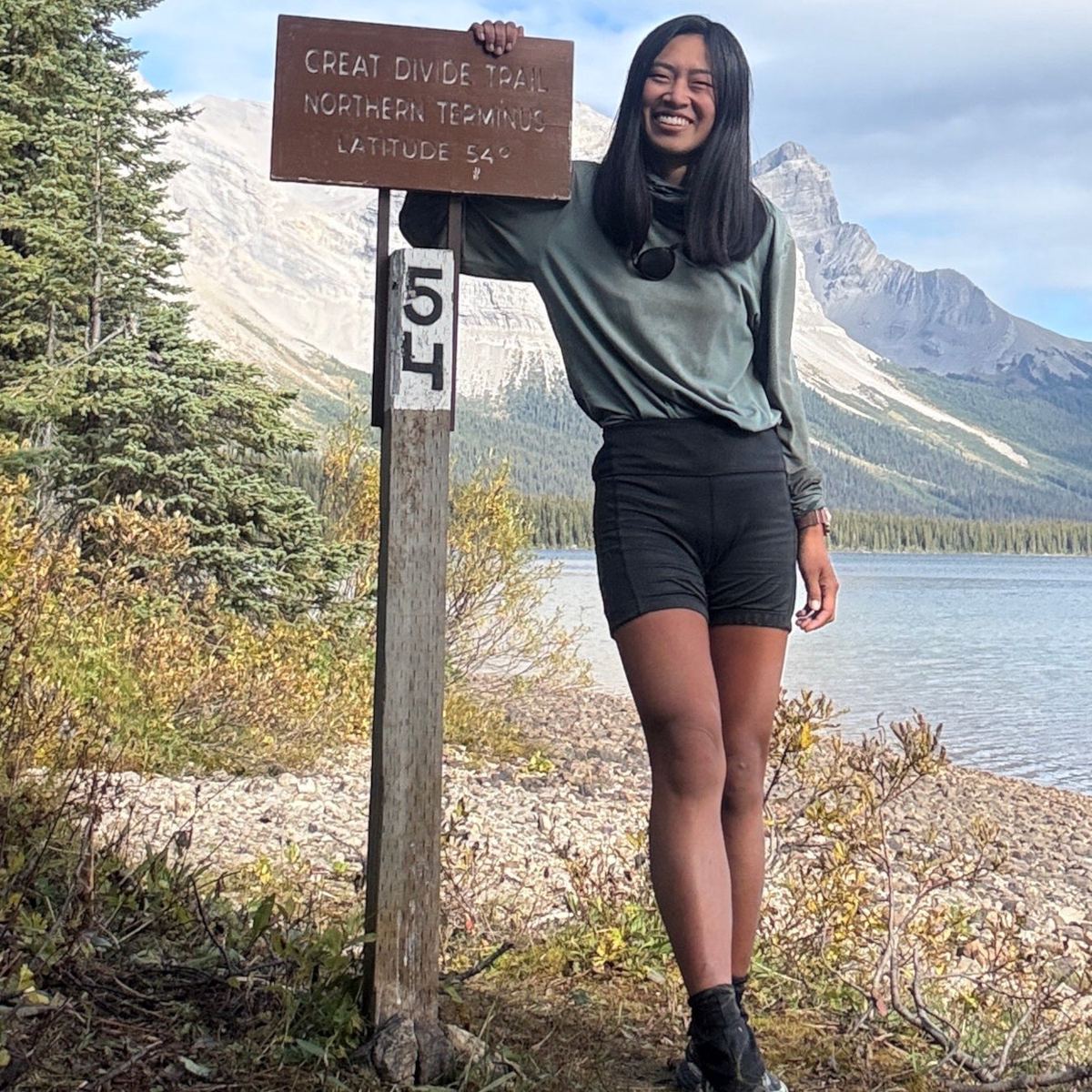
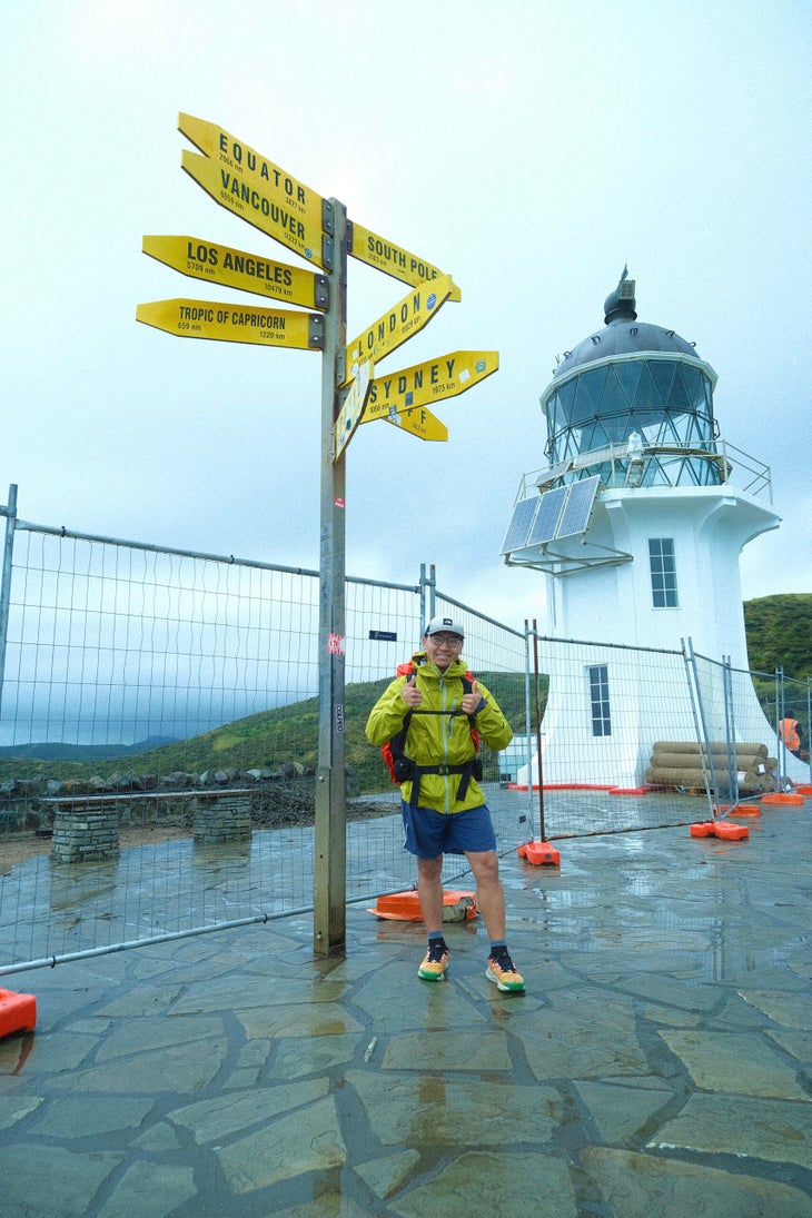
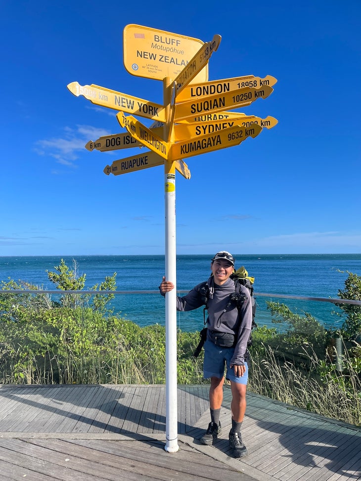
- Location: The North Island’s northern terminus is at Cape Reinga, where the Tasman Sea meets the Pacific Ocean, and the South Island’s southern terminus is Stirling Point at Bluff. Hiking SOBO is the most popular, primarily due to seasonality and weather conditions.
- Best Time to hike: September through March
- Navigation: The free Te Araroa app is a great comprehensive resource with all the official information from the trail map, notes, updated track alerts, and warnings to places you can re-supply, along with the contact information of trail angels and campsites.
- Wildlife: Some non-native mammals, such as possums and rats, can be a nuisance on the trail because they constantly steal your food. Kea and Weka birds like to destroy gear, and sandflies leave long-lasting itchy bites.
North Island vs. South Island
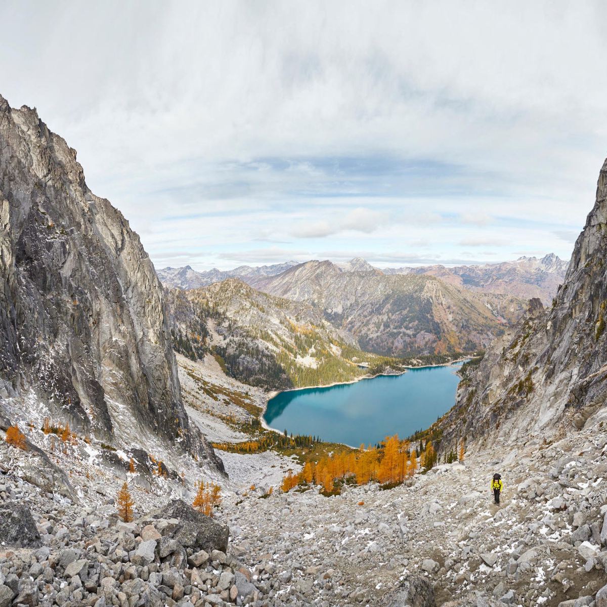
Traveling through the North and South Islands felt like two separate journeys. The hike through North Island is just over 994 miles (1,600 km) long, and the South Island is a bit shorter at just under 870 miles (1,400 km). The North Island offers a front-country experience with scenic, historic, and recreational trails. With close proximity to cities, hikers can explore the rich history and culture just a couple steps from the trail. Accommodation options include local hostels, campsites, and trail angels. Alternatively, the South Island is more remote, offering more of a backcountry experience, with hut-to-hut hiking through steep, rugged, and challenging mountain terrain, including multiple river crossings.
Where and When to Start your Hike
Due to seasons and weather, timing is crucial when choosing the direction of your Te Araroa journey. For a SOBO hike from Cape Reinga to Bluff, start between early September and early December. This ensures a tentative finish by the end of April, thus avoiding the worst snow and heavy rain in the South Island high country before the onset of autumn. For a NOBO hike from Bluff to Cape Reinga, start in December or January to make the most of long summer days as you power through the South Island’s rugged terrain.
What Permits and Visas Do I Need to Walk the TA?
Register with the Te Araroa Trust to complete the full trail, just an island, or any of the 160 tracks. Registered walkers get an info package and exclusive merchandise like a TA badge. Registration costs $36 USD ($60 NZD).
The Te Araroa Trust and the Department of Conservation (DOC) have launched a new Trail Pass program for the 2024/25 summer. With 60 percent of the trail on conservation land managed by the DOC, the pass priced at $120 USD ($195 NZD) can be used to stay at 71 DOC huts and campsites along the trail while providing a 20 percent discount at other huts and campsites (bookable through the DOC website).
A note for out-of-country tourists: If you intend to stay in New Zealand for over three months, you must obtain a visitor visa. It typically takes between four and six months to complete the trail.
What to Expect on Te Araroa
Weather and Trail Conditions
New Zealand’s weather is erratic, often having all four seasons in a day. Be prepared for any weather, regardless of the forecast. I relied on my Garmin inReach throughout my journey to stay in touch and check the weather daily. I mostly used MetService, followed by the rural and mountain forecasts.
Hut-to-Hut Hiking
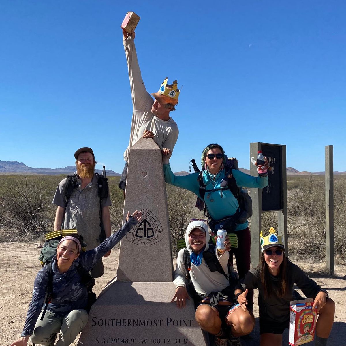
The huts on the TA are a significant part of the journey. Meeting fellow hikers gives you more reason to celebrate your accomplishments and get introspective on your experience so far. Huts cultivate conviviality and camaraderie among walkers and offer respite from the trail. In the harshest weather, the huts prove their worth. While braving the tumultuous ranges in Tararua Forest Park, a sudden downpour compelled 11 of us to seek refuge in a cramped six-bunk Captains Creek hut. Rather than wallowing, we rallied together, sharing food, stories, and laughter while the storm raged outside.
Trail Angels and Cultural Immersion
Similar to the Pacific Crest and Appalachian trails, trail angel culture is very special on the TA. What makes it different is the widespread, growing network of trail angels entwined with the Māori concept of koha, translated as gift, present, donation, or contribution. Koha is not expected, but when trail angels open their hearts and doors to their homes, it is nice to give back and show gratitude, whether through money, gifts, or doing chores.
Is Te Araroa a Difficult Trail?
Some sections of the TA are less of a walk and more of a mobility test—requiring climbing, crawling, and scrambling. Switchbacks don’t exist on the Te Araroa trail; there are continuous steep ascents and descents. Some notorious sections are the Tararua ranges on the North Island, beginning at 492 feet (150 meters) and reaching a peak of 4,796 feet (1,462 meters). For me, the most physically demanding section on the South Island was when I scrambled a 5,575-foot (1,700-meter) peak, only a half mile after ascending the treacherous Little Rintoul Summit at 5,360 feet (1,634-meter) on the Richmond Ranges.
These challenging terrains combined with New Zealand’s unpredictable weather conditions can pose life-threatening risks. Every person I met along the trail described the TA as their most demanding adventure, so come to the trail physically and mentally prepared.
There are resources, however, that can make your trip a little easier. Through the trail’s app and website, you can explore real-time trail notes and essential information for accommodation, food, transport, and resupplying. Note that details on the trail and contacts of hostels, campsites, and trail angels may change during your trip. Also, hikers can download Te Araroa trail maps and either print them or pull them up on their smartphones.
How Can Walkers Give Back?
“Whakahou,” which means “regeneration” in Māori, is a Te Araroa Trust project that hopes to make the TA the world’s first regenerative trail. This project focuses on safeguarding and enriching the trail’s biodiversity, improving the trail and its infrastructure, and minimizing environmental impacts. The TA does so by involving hikers, volunteers and trail supporters in regenerative initiatives such as tree planting, pest control, and fundraising initiatives.
People can also contribute through donations to the Te Araroa Trust, which funds trail maintenance and development. Recommended donations range from $150 USD for section hikers to $510 USD for thru-hikers.
From 2024