Los Angeles: Telegraph Canyon via Diemer Trial
Los Angeles: Telegraph Canyon via Diemer Trial
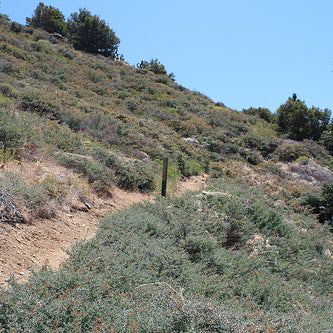
Cross a rolling ridgeline with great views of Orange County before descending down into the beautiful sycamore-, manzanita-, maple-, and wild zucchini-filled Telegraph Canyon.
Heading out the door? Read this article on the new Outside+ app available now on iOS devices for members! Download the app.
Trail Facts
- Distance: 8.2
Waypoints
DTL001
Location: 33.9094581604004, -117.780578613281
Facing the park entrance sign, go L on South Ridge Trail
DTL002
Location: 33.9094123840332, -117.787483215332
Overlook showcases hills formed by the uplift and folding of the nearby Whittier and Chino faults
DLT003
Location: 33.9123573303223, -117.803764343262
R @ Y onto Diemer Trail; steep hike down into Telegraph Canyon
DLT004
Location: 33.9143409729004, -117.803672790527
Canyon bottom; R @ Y onto Telegraph Canyon Trail
DLT005
Location: 33.9131546020508, -117.79727935791
Look for red-tailed hawks catching thermals along canyon walls
DLT006
Location: 33.9134750366211, -117.791061401367
Incredible old maple tree; great lunch and shade spot
DTL007
Location: 33.914421081543, -117.780151367188
Dry creek bed where an unnamed bike trail enters
DTL008
Location: 33.9150352478027, -117.769538879395
R @ Y on Little Canyon Trail; ascend for .3 mi.
DTL009
Location: 33.9111595153809, -117.769203186035
R @ T onto South Ridge Trail


