Portland, OR: Marys Peak
Portland, OR: Marys Peak
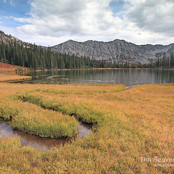
Bag the highest peak in the Coast Range on this 6.1-mile out-and-back where wind, sun, and altitude create several unique ecosystems.
Heading out the door? Read this article on the new Outside+ app available now on iOS devices for members! Download the app.
Trail Facts
- Distance: 9.8
Waypoints
MYS001
Location: 44.495491, -123.5430984
Hop on the East Ridge Trail in NW corner of lot
MYS002
Location: 44.4970512, -123.5445023
Cross unpaved FR 2005 and continue straight
MYS003
Location: 44.5033417, -123.5435028
Look E into Willamette Valley
MYS004
Location: 44.5095443, -123.5419893
Make sharp L @ Y, staying on East Ridge Trail
MYS005
Location: 44.5057487, -123.5454025
Long switchback R. Botanists recognize more than 200 plants around Marys Peak, including large stands of Douglas firs
MYS006
Location: 44.5100645, -123.548727
Switchback L; trail ribbons up steep slope
MYS007
Location: 44.5080752, -123.5456586
Switchback R again
MYS008
Location: 44.5091617, -123.5493064
Swing L onto Summit Trail
MYS009
Location: 44.5060246, -123.5503364
Cross road and pick up trail again under evergreen canopy
MYS010
Location: 44.5061798, -123.5514984
Turn L @ 3-way for last ascent to summit
MYS011
Location: 44.5042954, -123.5524392
Marys Peak: Connect views from the Pacific Ocean to the snowy spine of the Cascades on this 4,097-ft. summit. Return to trailhead