Tallahassee, FL: Leon Sinks Loop
Tallahassee, FL: Leon Sinks Loop
Spend a laid-back afternoon in a unique geologic area chock full of swamps and sinkholes on a fascinating 4.4-mile loop in Apalachicola National Forest.
Heading out the door? Read this article on the new Outside+ app available now on iOS devices for members! Download the app.
-Mapped by Eli Schelin


Trail Facts
- Distance: 7.1
Waypoints
LSL001
Location: 30.309731, -84.346184
Begin hiking W toward Sinkhole Trail
LSL002
Location: 30.310369, -84.346786
L @ T onto Sinkhole Trail; at next T, go L to find Gopher Hole, a gaping sinkhole worth the short side trip
LSL003
Location: 30.30854, -84.348618
Straight @ T onto green-blazed Gumswamp Trail, a 1.7-mi. stretch through a classic FL swamp; may be wet in summer
LSL004
Location: 30.305651, -84.348307
High-water marks on tupelo trees give sense of rainy-season depth. Continue through Shadow and South Swamps
LSL005
Location: 30.30698, -84.352547
Continue past Bear Scratch Swamp. Cypress mixes with tupelo here
LSL006
Location: 30.30448, -84.358627
Trail swings N. See dogwood blossoms in March, smell faint citrus of magnolia blooms in April and May
LSL007
Location: 30.30854, -84.355843
Rejoin blue-blazed Sinkhole Trail. For short trip back to parking lot, go R and follow Crossover Trail .5 mi. to WPT 3
LSL008
Location: 30.309669, -84.356117
R @ Y to footbridge over Lost Stream. If area is flooded, turn L @ Y to cut around on a short bypass trail
LSL009
Location: 30.31761, -84.355667
Magnolia Sink: Groundwater draining from eroded limestone caves can collapse roof, forming a sinkhole
LSL010
Location: 30.31558, -84.351173
Observation platform offers a look over Big Dismal Sink. Steep, plant-lined walls plunge into water 100 ft. below
LSL011
Location: 30.314779, -84.347252
Hammock Sink: Divers found underwater rooms, some 6 stories tall, in this depression; continue around a few more sinks to WPT 2; backtrack to trailhead
Fisher Creek Sink
Location: 30.308067, -84.356224
Fisher Creek Sink ©Eli Schelin
Black Sink
Location: 30.313957, -84.353714
This is one of several wet sinkholes in this area. ©Eli Schelin
Hammock Sink
Location: 30.314838, -84.346977
Hammock Sink ©Eli Schelin
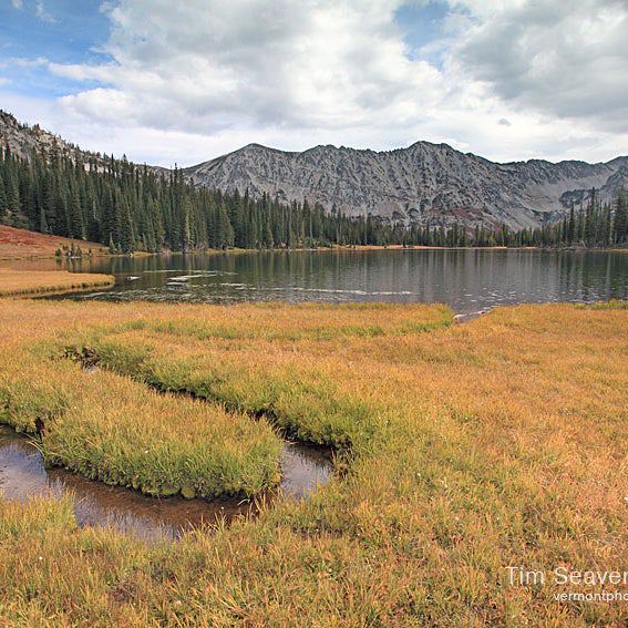
Big Dismal Sink
Location: 30.315662, -84.351593
Big Dismal Sink ©Eli Schelin
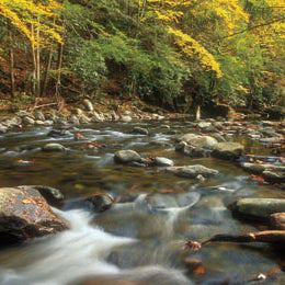
Lost Stream
Location: 30.309755, -84.355774
Wooden footbridge crosses the stream. ©Eli Schelin
Pine and Hardwood Forest
Location: 30.305048, -84.358269
Gallberry and fetterbush grow among the slash pine in moist locations and longleaf pines grow on sandy ridges along the trail. Also look for red and white oak, tupelo, hickory, ash, maple, and beech. ©Eli Schelin
Tupelo Trees in Shadow Swamp
Location: 30.305779, -84.348518
Notice the high water marks showing the water level during rainy season. ©Eli Schelin
Gopher Hole
Location: 30.308666, -84.347595
The Gopher Hole is a unique sink and member of the Leon Sinks under water cave system. ©Eli Schelin