This Hiking Paradise In The Heartland Flies Under The Radar
This Hiking Paradise In The Heartland Flies Under The Radar
Want in on one of the Midwest’s best-kept secrets for urban hiking? Head to Minneapolis.

Heading out the door? Read this article on the new Outside+ app available now on iOS devices for members! Download the app.
Even in the metropolis that is Minneapolis, you’ll find nature running wild. Here, you can hike among glacial-carved gorges, in boundless boreal forests, and below a 50-foot waterfall—all within city limits. From the “laughing waters” of Minnehaha Falls to panoramic lookouts over the Mississippi River to the stretches of America’s longest continuous public urban parkway system—the Grand Rounds National Scenic Byway—hikers can take their pick of an abundance of trails scattered across town. Plus, when you wrap up your hike, you’re on the doorstep of world-class food, arts, and culture. Here are five must-hike trails in and around Minneapolis that you won’t regret exploring.
Winchell Trail
Trail Type: Out-and-Back
Mileage: 5.4 miles
Walk in the footsteps of the Dakota people on the oldest hiking trail in the Minneapolis urban park system. The Winchell Trail follows 5 miles of the Mississippi National River and Recreation Area, a 72-mile protected river park that runs through the heart of the Twin Cities. Along mostly dirt and gravel pathways, with a few sections of paved trail, hikers will soak in industrial and natural beauty—walking under massive steel truss and concrete bridges, up and down natural rock staircases, and through thick sections of maple, ash, and oak forest. You can easily hike the route in two hours or peel off-trail into the Hiawatha or Cooper neighborhoods for food and drink to break up the trip. Our favorites include Venn Brewing Company in Hiawatha and the Milkweed coffee shop in Cooper—each under a mile off the trail. The majority of the route sits high in the Mississippi River Gorge above the riverbank, so you’ll soak in vista views between breaks in the trees. Hike here in the fall or winter for an even clearer lookout over the Ojibwe-named Misi-ziibi, meaning “great river.”
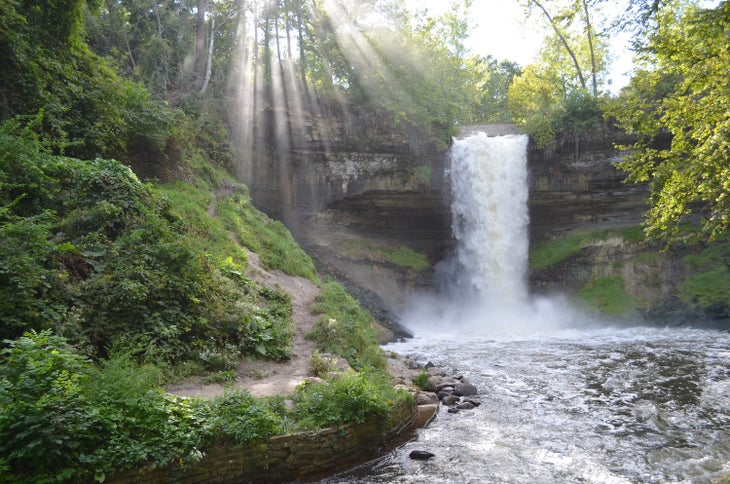
Minnehaha Falls Lower Glen Trail
Trail Type: Loop
Mileage: 2.1 miles
Microdose adventure with a hike around Minnehaha Falls—the centerpiece of the historic Minnehaha Regional Park, one of the first state parks in the U.S. The famous 53-foot waterfall spills over a limestone bluff into Minnehaha Creek before flowing into the Mississippi River. A short 0.2-mile walk from the Minnehaha Falls trailhead parking lot leads to the base of the falls, but the longer 2.1-mile Minnehaha Falls Lower Glen Trail is worth the extra effort. The route loops the entire 193-acre city park flush with silver maple, elm, and cottonwood trees, and prairie and woodland wildflowers that peak in spring and continue through early summer. Common wildflowers in this urban park include yellow trout lily and marsh marigold, large-flowered white trillium, and purple pasque flowers. Most blooms pop along the bank of the Minnehaha Creek, which the trail runs adjacent to for most of the hike. Keep a close watch for otters in the creek year-round, and although it’s a rarer sight, bald eagles overhead between December and March. Fun fact: The state has seen a remarkable comeback of its local bald eagle population, with well over 9,800 nesting pairs.
Theodore Wirth North Loop Trail
Trail Type: Loop
Mileage: 3 miles
Sandwiched between a cluster of urban lakes (there are 22 in and around the Twin Cities) 2 miles west of Minneapolis, the Theodore Wirth North Loop Trail boasts hilly topography and pristine single-track trails. This 3-mile loop is part of several inter-connected trail systems making up over a dozen miles of hikeable routes that wind their way through the 740-acre Theodore Wirth Regional Park—the largest in the Minneapolis park system. The North Loop Trail takes hikers through dense forest of oak and red maple, which light up in fiery red and golden yellow in the fall. Make way for mountain bikes that share this trail. Walkers, bikers, and runners can also access the 63-mile paved Luce Line State Trail that intersects with the North Loop. You’ll come across impressive views of the Minneapolis skyline while riding or hiking on the north side of Theodore Wirth Park about a quarter-mile along the trail from the intersection.
Southern Voyager Trail
Trail Type: Out-and-Back
Mileage: 5 miles
Break free from city limits at Lebanon Hills Regional Park. Locals call this natural area “Boundary Waters South” as it gives adventurers a taste of the wild beauty of the Minnesota Boundary Waters just 30 minutes from the Twin Cities. The glacial-moraine-carved landscape features hilly terrain and a smattering of lakes and ponds throughout the park. You can even portage a canoe between the waterways (hence the nickname). Chart your own course on more than 15 miles of crisscrossing trail or hike the 5-mile Southern Voyager Trail Hiking Trail—the hallmark hike of the park. The route traces the edge of several lakes and crosses through tamarack swamp, native prairies, and thick sugar maple and red oak woodland. Spring and fall are ideal times to hike for changing foliage and blossoming wildflowers, but winter provides solitude like you won’t find anywhere else this close to the city.
Superior Hiking Trail
Trail Type: Point-to-Point
Mileage: 295 miles
Think the Midwest is nothing but flatland? You’ll think again after a couple miles on the SHT. Elevation hounds will love the consistent ascents and descents along the trail—a distinguishable contrast to the rest of the hiking you’ll find in the Midwest. Those who complete the full trek will gain tens of thousands of feet in elevation along the 300-mile-long trail. Reminiscent of New Brunswick’s Fundy Coast, the dramatic coastal journey up the North Shore of Lake Superior to the Canadian border traces landscapes formed by the Great Ice Age 2.5 million years ago. En route, hikers soak in stunning views of the world’s largest freshwater lake from lookouts that disappear on descents into boreal forests filled with aspen, pine, fir, and cedar. If the full distance is too much to take on in one go, consider bite-sized treks on popular segments like Lutsen to Grand Marais (35 miles) and Two Harbors to Silver Bay (45 miles). No fees or permits are required to hike the Superior Hiking Trail and all 94 campsites are first-come, first-served.
When to hike
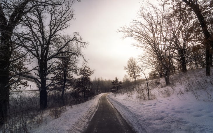
Winter weather turns Minneapolis into a frozen tundra by mid-January. Look to late spring through early fall for the best hiking in and around the Twin Cities. Conditions in early spring are typically cold and snowy, but the weather warms up and thaws the trails by the end of May. Spring temperatures range from lows in the 50s in May to highs in the upper 80s by the end of June and July. Summertime is prime for camping and hiking, with averages ranging from the low 60s to the low 80s. If you’re on the hunt for fall color, foliage peaks mid-to-late-September through mid-October. With often unpredictable weather in the Midwest, it’s smart to pack a waterproof jacket and an extra layer or two whenever you head out to hike—especially during shoulder seasons.
Where to stay and eat
The centrally located Elliot Park Hotel is a short drive to nearby trails and walking distance to downtown nightlife. Grab post-hike pints at local favorites like Surly Brewing and Urban Growler Brewing Company, the first women-owned microbrewery in the state of Minnesota. For a farm-to-table meal, dine at Tullibee in the Hewing Hotel in the North Loop neighborhood. The restaurant leans into Minneapolis’ Scandinavian roots with cuisine ranging from locally caught fish from Lake Superior and vegetable-forward dishes featuring foraged edibles like herbs and mushrooms from nearby forests. To curb your post-hike hunger with a more casual meal, scarf down a Juicy Lucy—an American burger stuffed with gooey cheese—from popular spots like Matt’s Bar or 5-8 Club.
From 2024