White Mountain National Forest: South Moat Mountain
White Mountain National Forest: South Moat Mountain
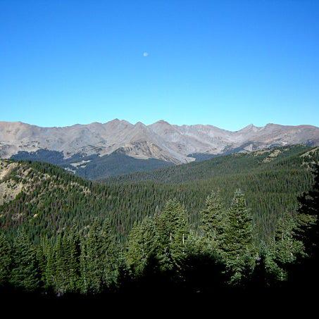
This brisk out-and-back quickly climbs nearly 2,000 feet in 2.5 miles to a long ridgeline with views of the Whites and a breezy summit.
Heading out the door? Read this article on the new Outside+ app available now on iOS devices for members! Download the app.
Trail Facts
- Distance: 4.1
Waypoints
SMM001
Location: 43.9936103820801, -71.183219909668
Hike N into under the forested shadow of Eagle Ledge
SMM002
Location: 43.9967498779297, -71.1830062866211
Gently climb the SE flank of Haystack Mtn.
SMM003
Location: 44.0032997131348, -71.188362121582
Cross Dry Brook over sturdy bridge in wooded gully
SMM004
Location: 44.004150390625, -71.1830749511719
Turn L onto Moat Mtn. Trail, head N
SMM005
Location: 44.0064506530762, -71.1849899291992
Break @ airy vista; look S at the Swift River rushing toward Conway with green hills tapering in all directions. Grab a snack before stout climb ahead.
SMM006
Location: 44.0084190368652, -71.1888122558594
Loose rock; use caution
SMM007
Location: 44.0109596252441, -71.1885375976562
Overlook to bald summits of Haystack Mtn. and Mt. Chocorua. Scant trail furrows NNW
SMM008
Location: 44.0133514404297, -71.1905517578125
More scenery unfolds @ outcrop
SMM009
Location: 44.0173606872559, -71.1934204101562
South Moat (2,772 ft.), the southern terminus of a long ridge connecting four peaks, with magnificent views of White Mountain National Forest. Retrace steps to your car